Catalogue PIGMA
/Biological Environment/Species/Fauna
Type of resources
Available actions
Topics
Keywords
Contact for the resource
Provided by
Years
Formats
Representation types
Update frequencies
status
Scale
Resolution
-
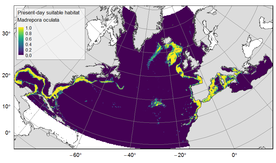
Distribution of predicted suitable habitat for six cold-water-coral, six deep-water fish and one sponge species, on the North Atlantic (18°N to 76°N and 36°E to 98°W). For each species, predicted habitat distribution was obtained for present-day conditions (1951-2000) and for the future climate refugias, i.e. the areas that were predicted as suitable both for present-day and forecasted future (2081-2010) conditions. The dataset gathers 26 raster layers created on the same grid of 25km * 25km resolution, downgraded from source layers (3km *3km resolution) that were created within the work package 3 of EU ATLAS project. The presence (value=1) of climate refugia and the relative cover (value ranging from 0 to 1) of present-day suitable habitat was extracted in gridsquares. This dataset was built to feed a basin-wide spatial conservation planning exercise, targeting the deep sea of the North Atlantic. The goal of this approach was to identify conservation priority areas for Vulnerable Marine Ecosystems (VMEs) and deep fish species, based on the distribution of species and habitats, human activities and current spatial management.
-
This dataset containing traits of marine fish is based on fish taxa observed during international scientific bottom-trawl surveys regularly conducted in the Northeast Atlantic, Northwest Atlantic and the Northeast Pacific. These scientific surveys target primarily demersal (bottom-dwelling) fish species, but pelagic species are also regularly recorded. The overarching aim of this dataset was to collect information on ecological traits for as many fish taxa as possible and to find area-specific trait values to account for intraspecific variation in traits, especially for widely distributed species. We collected traits for species, genera and families. The majority of trait values were sourced from FishBase (Froese and Pauly, 2019), and have been supplemented with values from the primary literature.
-
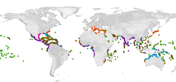
SWOT - the State of the World's Sea Turtles - is a partnership led by Marine Flagship Species Program at the Oceanic Society, Conservation International (CI), the IUCN Marine Turtle Specialist Group (MTSG), and supported by the OBIS-SEAMAP project at the Marine Geospatial Ecology Lab (MGEL), Duke University. This Database allows mapping marine turtle available data. Here is presented - location of nesting sites per species - the Abundance per nesting site
-
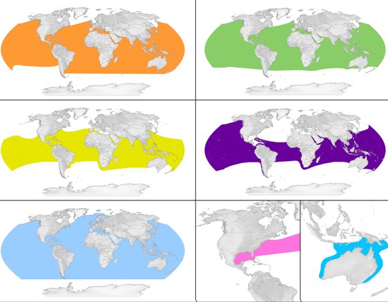
SWOT - the State of the World's Sea Turtles - is a partnership led by Marine Flagship Species Program at the Oceanic Society, Conservation International (CI), the IUCN Marine Turtle Specialist Group (MTSG), and supported by the OBIS-SEAMAP project at the Marine Geospatial Ecology Lab (MGEL), Duke University. This Database allows mapping marine turtle available data. Here is presented - the world distribution by species
-
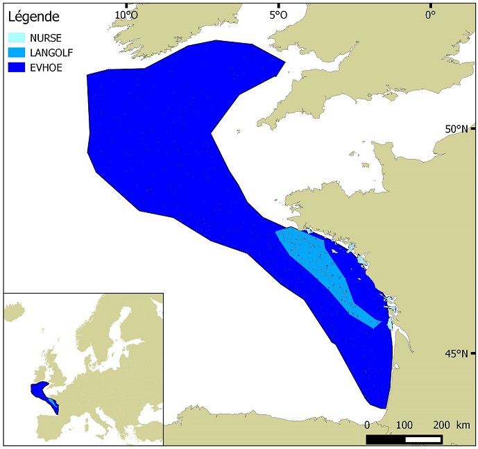
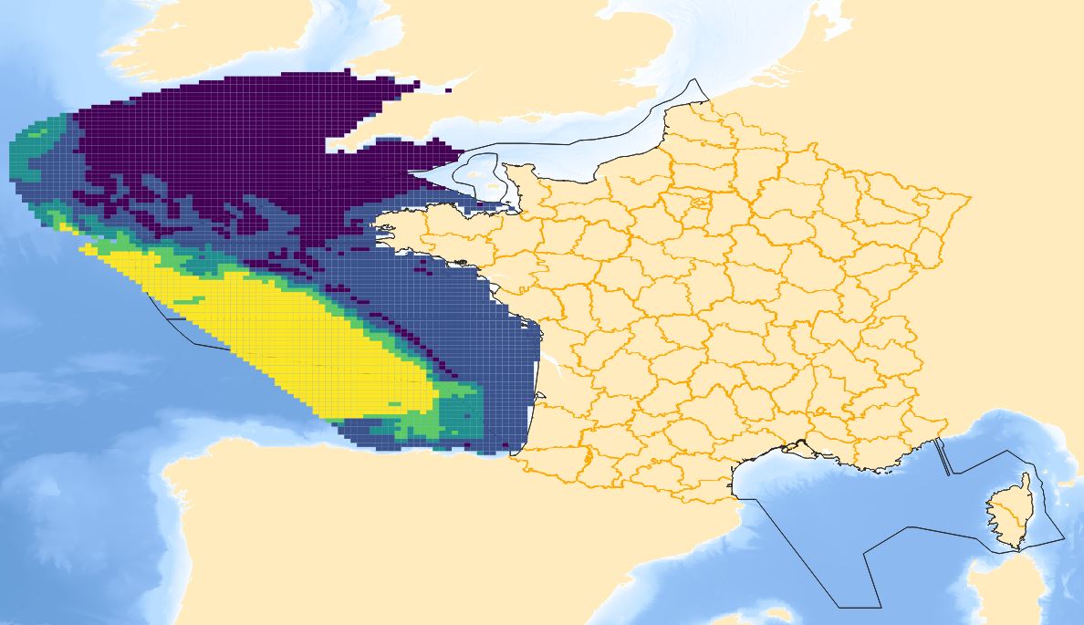
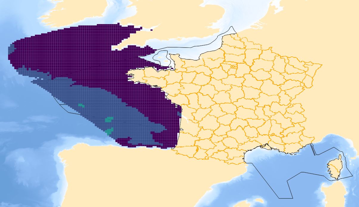
Distribution of benthic invertebrate species in Atlantic based on cumulative and interpolated relative abundance density data from fisheries surveys EVHOE (2008-2013), LANGOLF (2011-2013), NURSE (2000-2013), ORHAGO (2011-2015)
-
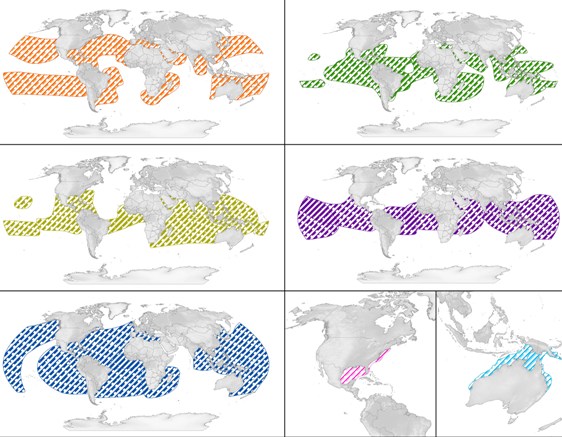
SWOT - the State of the World's Sea Turtles - is a partnership led by Marine Flagship Species Program at the Oceanic Society, Conservation International (CI), the IUCN Marine Turtle Specialist Group (MTSG), and supported by the OBIS-SEAMAP project at the Marine Geospatial Ecology Lab (MGEL), Duke University. This Database allows mapping marine turtle available data. Here is presented - the World Regional Managment Units for all species
-

The International Whaling Commission was set up under the International Convention for the Regulation of Whaling which was signed in Washington DC on 2nd December 1946. The preamble to the Convention states that its purpose is to provide for the proper conservation of whale stocks and thus make possible the orderly development of the whaling industry. The Commission undertakes extensive study and research on cetacean populations, develops and maintains scientific databases, and publishes its own peer reviewed scientific journal, the Journal of Cetacean Research and Management. A list of catches since the moratorium came into place (in the 1985/6 Antarctic Season) up to 2019 (download link).
-
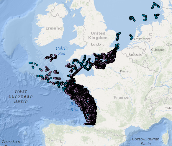
Occurrence data for marine mammals, birds and other marine megafauna collected by Megascope on fishing and oceanographic surveys (date, position, species).
-
-